|
Source:
Historical Collections of Ohio:
An Encyclopedia of the State:
History both General and Local, Geography with Descriptions of its
Counties, Cities and Villages, Its Agricultural, Manufacturing,
Mining and Business Development,
Sketches of Eminent and Interesting Characters, etc.,
With Notes of a Tour Over it in 1886.
ILLUSTRATED BY ABOUT SEVEN HUNDRED ENGRAVINGS.
Contrasting the Ohio of 1846 with 1886-90.
From drawings by the author in 1846 and photographs taken solely for
it in
1886, 1887, 1888, 1889, and 1890, of cities and chief towns, public
buildings, historic localities, monuments, curiosities,
antiquities, portraits, maps, etc.
By Henry Howe, LL. D.,
Author "Historical Collections of Virginia"
and other works.
VOLUME III
Columbus:
Henry Howe & Son.
Copyright 1891 by Henry Howe
1891
|
[Page 557]
WOOD COUNTY was
formed from old Indian Territory, April 1, 1820, and named
from the brave and chivalrous Col. Wood, a
distinguished officer of engineers in the war of 1812.
The surface is level, and covered by the black swamp, the
soil of which is a rich, black loam, and very fertile, and
peculiarly well adapted to grazing. The population are
mainly of New England descent, with some Germans. The
principal crops are corn, hay, potatoes, oats and wheat.
Area about 620 square miles. In 1887 the acres
cultivated were 157,492; in pasture, 26,485; woodland,
65,055; lying waste, 1,059; produced in wheat, 661,013
bushels; rye, 104,379 (largest in the State); buckwheat,
1,560; oats, 815,896; barley, 27,080; corn, 1,884,832;
meadow hay, 21,000 tons; clover, 6,095; flaxseed, 84
bushels; potatoes, 88,656; tobacco, 70 lbs.; butter,
635,765; sorghum, 2,274 gallons; maple syrup, 4,873; honey,
21,140 lbs.; eggs, 749,213 dozen; grapes, 56,220 lbs.; wine,
962 gallons; sweet potatoes, 21 bushels; apples, 39,660;
peaches, 1,383; pears, 1,537; wool, 83,799 lbs.; milch cows
owned, 8,481. Ohio Mining Statistics, 1888; Limestone,
36,565 tons burned for lime; 81,000 cubic feet of dimension
stone; 57,199 cubic yards of building stone; 8,892 cubic
feet of ballast or macadam. School census, 1888,
12,763; teachers, 410. Miles of railroad track, 196
| Townships and Census |
1840 |
1880 |
|
Townships and Census |
1840 |
1880 |
| Bloom, |
437 |
2,022 |
|
Montgomery, |
609 |
2,283 |
| Center |
97 |
2,023 |
|
Perry |
559 |
1,474 |
| Freedom, |
238 |
1,667 |
|
Perrysburg, |
1041 |
4,112 |
| Henry, |
213 |
1,688 |
|
Plain, |
272 |
1,985 |
| Jackson, |
27 |
1,028 |
|
Portage, |
1099 |
1,434 |
| Lake, |
|
2,207 |
|
Ross |
|
639 |
| Liberty, |
215 |
1,292 |
|
Troy, |
383 |
1,407 |
| Middleton, |
193 |
1,606 |
|
Washington, |
244 |
1,426 |
| Milton and Weston, |
639 |
|
|
Webster, |
|
1,197 |
| Miton, |
|
2,181 |
|
Weston, |
|
2,351 |
Population of wood in 1830,
1,096; 1840, 5,458; 1850, 9,165; 1860, 17,886; 1880, 34,022; of whom
25,808 were born in Ohio; 1,569, Pennsylvania; 1204, New York; 169,
Virginia; 158, Indiana; 38, Kentucky; 2092, German Empire; 626,
England and Wales; 321, British America; 274 Ireland; 118, France;
110, Scotland; and 21, Norway and Sweden. Census, 1890,
44,392.
DRAINAGE.
Since our original edition
of 1847 few counties of the State have been so surprisingly
transformed as Wood. It was then an almost unbroken forest,
covering the black swamp, and with few inhabitants. This
advance has been owing to the very extensive system of drainage and
clearing off the forest, which has brought a large body of
agriculturalists to settle up the country, three-fourths of whom
are, to-day, within a radius of about 2 1/2 miles of some line of
railway; hence there has been a steady and uniform advance in
agricultural development. It is now fast becoming one of
the great garden spots of the country.
What drainage is doing for this entire region is told
in the article, "The Black Swamp," under the head of Putnam County.
One single ditch in Wood county, the "Jackson Cut-off," drains
30,000 acres, and cost $110,000. It is therein stated that,
counting in the railway ditches with the public and private ditches
of the farmers, there are in Wood county alone 16,000 miles of
ditches, at an aggre-
[Page 558]
gate cost of millions of dollars. These are the basis
of the great agricultural prosperity of the county in
connection with the richness of the soil. And later,
comes the discovery and use of its great gas and oil
resources to further enhance its prosperity.
EARLY HISTORY.
The
following sketch of the early history of this region was
communicated to our original edition by Hezekiah L.
Hosmer, then a young lawyer of Perrysburg. He
eventually removed to the Pacific Slope, and held there a
high judicial position. |
The
Military Expeditions against the Indian tribes in the
West, commenced under the colonial government about the
middle of the last century, were finally terminated on this
river by the decisive victory of Gen. Wayne in 1794.
Previous to that event no portion of the West was more
beloved by the Indians than the valleys of the Maumee and
its tributaries. In the daily journal of Wayne's
campaign, kept by George Will, under date of Aug. 6,
1794, when the army was encamped fifty-six miles in advance
of Fort Recovery, the writer says: "We are within six miles
of the Auglaize river, and I expect to eat green corn
to-morrow." On the 8th of the same month, after the
arrival of the army at the Camp Grand Auglaize (the site of
Fort Defiance), he continues: "We have marched four or five
miles in corn-fields down the Auglaize, and there is not
less than 1,000 acres of corn around the town." This
journal, kept from that time until the return of the army to
Fort Greenville, is full of descriptions of the immense
corn-fields, large vegetable patches, and old apple trees,
found along the banks of the Maumee from its mouth to Fort
Wayne. It discloses the astonishing fact that for a
period of eight days while building Fort Defiance, the army
obtained their bread and vegetables from the corn-fields and
potato patches surrounding the fort. In their march
from Fort Defiance to the foot of the rapids the army passed
through a number of Indian towns composed of huts,
constructed of bark and skins, which afforded evidence that
the people who had once inhabited them were composed, not
only of Indians, but of Canadian French and renegade
Englishmen.
The Maumee Valley After Wayne's
Victory. - What the condition of the valley was
for some years after Wayne's campaign may be gathered from
the following extracts from one of Judge Burnet's
letters, published by the Ohio Historical Society.
After assigning some reasons for the downfall of the
Indians, he says: "My yearly trips to Detroit, from 1796 to
1802, made it necessary to pass through some of their towns,
and convenient to visit many of them. Of course I had
frequent opportunities of seeing thousands of them, in their
villages and at their hunting camps, and of forming a
personal acquaintance with some of their distinguished
chiefs. I have eat and slept in their towns, and
partaken of their hospitality, which had no limit but that
of their contracted means. In journeying more recently
through the State, in discharging my judicial duties, I |
|
sometimes passed over the
ground on which I had seen towns filled with happy families
of that devoted race without perceiving the smallest trace
of what had once been there. All their ancient
settlements on the route to Fort Defiance, and from thence
to the foot of the rapids, had been broken up and deserted.
"The battle-ground of Gen. Wayne, which I had
often seen in the rude state in which it was when the
decisive action of 1794 was fought, was so altered and
changed that I could not recognize it, and not an indication
remained of the very extensive Indian settlements which I
had formerly seen there. It seemed almost impossible
that in so short a period such an astonishing change could
have taken place."
These extracts prove that even after the battle of
Presque Isle, although crushed and humbled, the Indian
refused to be divorce from the favorite home and numerous
graves of is race. A chain of causes which followed
this battle finally wrested from him the last foothold of
his soil. These may be said to have commenced with the
treaty of Greenville, made on the 3d of August, 1795, with
the Wyandots, Ottawas, and other tribes located in this
region. By this treaty, among various other cessions
of territory, a tract of land twelve miles square at the
foot of the rapids, and one of six miles square at the mouth
of the river, were given to the United States. This
treaty was followed by the establishment of the boundaries
of the county of Wayne, which included a part of the States
of Ohio, Indiana, and the whole of Michigan.
The First White Settler. - Notwithstanding this
actual declaration of ownerships by the government, few only
of the whites of the country were willing to penetrate and
reside in this yet unforsaken abode of the Indian.
Col. John Anderson was the first white trader of any
notoriety on the Maumee. He settled at Fort Miami as
early as 1800. Peter Manor, a Frenchman, was
here previous to that time, and was adopted by the chief
Fontogany, by the name of Sawendebans or
"the Yellow Hair." Manor,
however, did not come here to reside until 1808.
Indeed, I cannot learn the names of any of the settlers
prior to 1810 except the two above mentioned. We may
mention among those who came during the year 1810.
Maj. Amos Spafford, Andrew Race, Thomas Leaming, Halsey W.
Leaming, James Carlin, Wm. Carter, George Bla- |
[Page 559] |
lock, James Slason, Samuel
H. Ewing, Jesse Skinner, David Hull, Thomas Dick, Wm.
Peters, Ambrose Hickox, Richard Gifford. All these
individuals were settled within a circumference of ten
miles, embracing the amphitheatre at the foot of the rapids,
as early as 1810. Maj. Amos Spafford
came here to perform the duties of collector of the port of
Miami. He was also appointed deputy postmaster.
A copy of his return to the government as collector for the
first quarter of his service, ending on the 30th June, 1810,
shows the aggregate amount of exports to have been
$5,640.85. This was, for skins and furs, $5,61.85, and
for twenty gallons of bear's oil, $30.
When War Broke out in 1812 there were
sixty-seven families residing at the foot of the rapids.
Manor - or Minard, the Frenchman above alluded
to - states that the first intimation that the settlers had
of Hull's surrender at Detroit manifested itself by
the appearance of a party of British and Indians at the foot
of the rapids a few days after it took place. The
Indians plunders the settlers on both sides of the river,
and departed for Detroit in canoes. Three of their
number remained with the intention of going into the
interior of the State. One of these was a Delaware
chief by the name of Sac-a-manc. Manor
won his confidence, under the pretence of friendship for the
British, and was by him informed that in a few days a grand
assemblage of all the northwestern tribes was contemplated
at Fort Malden, and that in about two days after that
assemblage a large number of British and Indians would be at
the foot of the rapids, on their march to relieve Fort
Wayne, then under investment by the American army, as was
supposed. He also informed him that, when they came
again, they would massacre all the Yankees found in the
valley. Sac-a-manc
left for the interior of the State, after remaining a day at
the foot of the rapids.
Flight of the Settlers. - The day after his
departure Minard called upon Maj. Spafford,
and warned him of the hostile intentions of the Indians, as
he had received them from Sac-a-manc. The major
placed no confidence in them, and expressed a determination
to remain until our army from the interior should reach this
frontier. A few days after this conversation a man by
the name of Gordon was seen approaching
the residence of Maj. Spafford in great
haste. This individual had been reared among the
Indians, but had, previous to this time, received some
favors of a trifling character from Maj. Spafford.
The major met him in his corn-field, and was informed that a
party of about fifty Pottawatomies, on their way to Malden,
had taken this route, and in less than two hours would be at
the foot of the rapids. He also urged the major to
make good his escape immediately. Most of the families
at the foot of the rapids had left the valley after
receiving intelligence of Hull's surrender. The
major |
assembled
those that were left on the bank of the river, where they
put in tolerable sailing condition an old barge, in which
some officers had descended the river from Fort Wayne the
year previous. They had barely time to get such of
their effects as were portable on board, and row down into
the bend below the town, before they heard the shouts of the
Indians above. Finding no Americans here, the Indians
passed on to Malden. The major and his companions
sailed in their crazy vessel down the lake to the Quaker
settlement at Milan, on Huron river, where they remained
until the close of the war.
Sac-a-manc, on his return from the interior of
the State, a few days after the event, showed Manor
the scalps of three persons that he had killed during his
absence, on Owl creek, near Mount Vernon. At the time
mentioned by him a detachment of the British army, under
command of Col. Elliott, accompanied by about 500
Indians, came to the foot of the rapids. They were
anxious to obtain guides. Manor feigned
lameness and ignorance of the country above the head of the
rapids, a distance of eighteen miles up the river. By
this means he escaped being pressed into their service above
that point. He accompanied them that far with his cart
and pony, and was then permitted to return. On his
return he met Col. Elliott, the commander of the
detachment, at the foot of Presque Isle Hill, who stopped
him, and, after learning the services he had performed,
permitted him, with a curse, to go on. A mile below
him he met a party of about forty Pottawatomies, who also
desired to know where he was going. Manor
escaped being compelled to return by telling them he was
returning to the foot of the rapids after forage for the
army. The British and Indians pursued their march up
the river until their saw the American flag waving over
Winchester's encampment at Defiance, when they returned in
double quick time to Canada. On their return they
burned the dwellings, stole the horses and destroyed the
corn-fields of the settlers at the foot of the rapids.
Manor, soon after his arrival at the foot of the
rapids, when down the river to the British fleet, then lying
at the mouth of Swan creek, under command of Capt. Mills.
Here he reported himself, told what he had done far the
army, and desired leave to go to his family at the mouth of
the river. Capt. Mills having no evidence of
his loyalty beyond his own word, put him under hatches as a
prisoner of war. Through the aid of his friend,
Beaugrand, Minard was released in a few days, joined his
family, and was afterwards a scout for our army during the
remainder of the war. He is now (1846 living at the
head of the rapids, on the reservation of land granted him
by the government, at the request of his Indian father,
Ton-tog-sa-ny. [Another account of Peter Manor
is in Lucas Count.]
After Peace was Declared, most of the settlers
that had lived here previous to the war returned to their
old possessions. They were partly indemnified by
government for their losses. Many of them lived in the
block-houses on Fort Meigs, and one or two |
[Page 560] |
|
| of the citizens
of our town were born in one of them. The settlement
of the valley was at first slow, but the foot of the rapids
and vicinity was settled long before any of the rest.
In 1816 government sent an agent to lay out a town at the
point best calculated for commercial purposes. That
agent sounded the river from its mouth, and fixed upon
Perrysburg. The town was laid out that year, and named
after Com. Perry by Hon. Josiah Meigs, then
Comptroller of the Treasury. This county was then
embraced in the county limits of Logan county, Bellefontaine
being the county-seat. When the limits of Wood county
county were first determined, there was a great struggle
between these |
three towns at the
foot of the rapids - Orleans, Maumee and Perrysburg - for
the county-seat. The decision in favor of Perrysburg
was the cause of the abandonment of the little town of
Orleans, which soon after fell into decay.
The last remnant of the powerful Ottawa tribe of
Indians removed from this valley west of the Mississippi in
1838. They numbered some interesting men among them.
There was Nawash, Ockquenoxy, Charloe, Ottoca, Petonquet,
men of eloquence, remembered by many of our citizens.
Their burying-grounds and village-sites are scattered along
both banks of the river, from its mouth to Fort Defiance. |
This
part of the Maumee valley has been noted for military
operations. Wayne's victory over the Indians (see
Lucas County), Aug. 20, 1794, was gained within its borders.
It was also the theatre of important operations in the war
of 1812. |
March of Gen. Hull - About the middle of June,
1812, the army of Hull left Urbana, and passed
through the present counties of Logan, Hardin, Hancock and
Wood, into Michigan. They cut a road through the
forest, and erected Forts M'Arthur and Findlay on the route,
and arrived at the Maumee on the 30th of June, which they
crossed at or near the foot of the rapids. Hull
surrendered at Detroit on the 16th of the August following.
Tupper's Expedition. - In the same summer,
Gen. Edward W. Tupper, of Gallia county, raised about
1,000 men for six months' duty, mainly from Gallia, Lawrence
and Jackson counties, who, under the orders of Gen.
Winchester, marched from Urbana north by the route of Hull,
and reached the foot of the Maumee rapids. The Indians
appearing in force on the opposite bank, Tupper
endeavored to cross the river with his troops in the night;
but the rapidity of the current, and the feeble,
half-starved condition of his men and horses were such, that
the attempt failed. The enemy soon after collected a
superior force, and attacked Tupper in his camp, but
were driven off with considerable loss. They returned
to Detroit, and the Americans marched back to Fort M'Arthur. |
|
Winchester's Defeat. - On the 10th of January, 1813,
Gen. Winchester, whose troops had been stationed at
Forts Wayne and Defiance, arrived at the rapids, having
marched from the latter along the north bank of the Maumee.
There they encamped until the 17th, when Winchester resumed
his march north, and was defeated with great loss on the 22d
of the river Raisin, near the site of Monroe, Michigan.
On receiving information of Winchester's defeat,
Gen. Harrison sent Dr. McKeehan from Portage
river with medicines and money to Malden, for the relief of
the wounded and the prisoners. He was accompanied by a
Frenchman and a militia-man, and was furnished with a letter
from Harrison, addressed to any British officer whom
he might meet, describing his errand. The night after
they left they halted at the Maumee rapids to take a few
hours' sleep, in a vacant cabin upon the north bank of the
river, about fifty rods north of the present bridge.
The cariole in which they travelled was left at the door,
with a flag of truce set up in it. They were
discovered in the night by a party of Indians, accompanied,
it is said, by a British officer; one of the men was killed,
and the others taken to Malden, where the doctor was thrown
into prison by Proctor an loaded with irons. |
|
THE BUILDING OF FORT MEIGS
After the defeat
of Winchester, Gen. Harrison, about the first of
February, established his advanced posts at the foot of the
rapids. HE ordered Capt. Wood, of the engineer
corps, to fortify the position, as it was his intention to
make this point his grand depot. the fort erected was
afterwards named Meigs, in honor of Governor Meigs.
Harrison ordered all the
troops in the rear to join him immediately. He was in
hopes, by the middle of February, to advance upon Malden,
and strike a blow that should in some measure retrieve the
misfortunes that had befallen the American arms in this
quarter.
On the 9th of February intelligence was brought
of the encampment of about 600 Indians, twenty miles down,
near the Bay shore. Harrison had with him,
[Page 561]
at this time about 2,000 men at the post. The same
night, or that following, 600 men left the fort under
Harrison, and marched down the river on the ice twenty
miles, when they discovered some fires on the north side of
the river, which proved to have been that of the Indians who
had fled the day before. Here the detachment, which
had been joined by 500 men more from the post, waited a few
minutes, without having time to warm themselves, it being
intensely cold, when the object of the expedition was made
known. This was to march after the Indians; and all
those unable by fatigue to continue were ordered to follow
the next day. On resuming the line of march the army
had proceeded only about two miles when their only cannon,
with the horses attached, broke through the ice. This
was about two hours before morning, and the moon
unfortunately was nearly down. In endeavoring to
extricate the horses, Lieut. Joseph H. Larwill, who
had charge of the piece, with two of his men, broke through
the ice and narrowly escaped drowning. The army
thereupon halted, and a company ordered to assist in
recovering the cannon, which was not accomplished until
daybreak. Some of the men gave out from being wet,
cold and fatigued; but the lieutenant, with the remainder,
proceeded with the cannon after the main army, which they
overtook shortly after sunrise, on an island near the mouth
of the bay. The spies were then arriving with the
intelligence that the Indians had left the river Raisin for
Malden. Upon this the troops, having exhausted their
provisions, returned, arriving at Fort Meigs just as the
evening gun had been fired, having performed a march of
forty-five miles on the ice in less than twenty-four hours.
LANGHAM'S DESPERATE ENTERPRISE.
A few hours after
this, about 250 men volunteered to go on an enterprise of
the most desperate nature. On Friday, the 26th, the
volunteer corps destined for this duty were addressed on
parade by Gen. Harrison, who informed them that when
they had got a sufficient distance from the fort they were
to be informed of the errand they were upon, and that all
who then wished could return, but not afterwards. He
represented the undertaking as in a high degree one of peril
and privation; but he promised that those who deported
themselves in a gallant and soldierlike manner should be
rewarded, and their names forwarded to the general
government.
The force, which was under the command of Capt.
Langham, consisted of 68 regulars, 120 Virginia and
Pennsylvania militia, 32 men under Lieut. Madiss and
22 Indians, making, with their officers, 242 men; besides
these were 24 driers of sleds and several pilots.
On the morning of the 2d of March they left the
block-house with six days' provisions, and had proceeded
about half a mile when Capt. Langham ordered a halt.
He addressed the soldiers and informed them of the object of
the expedition, which was to move down to Lake Erie and
cross over the ice to Malden, and, in the darkness of night,
to destroy with combustibles the British fleet and the
public stores on the bank of the river. This done, the
men were to retreat in their sleighs to the point of the
maumee bay, when their retreat was to be covered by a large
force under Harrison. At this time, independent of the
garrison at Malden, in that vicinity was a large body of
Indians, and it required a combination of circumstances to
render the enterprise successful. Capt. Langham
gave liberty for all who judged it too hazardous to
withdraw. Twenty of the militia and six or seven of
the Indians availed themselves of the liberty. The
rest moved down the river in sleighs, and took the land on
the west side of the bay, passing through and across the
peninsula, and crossed at the bay of Portage river, and soon
came in view of the lake and its embosoming islands.
Some of the men
[Page 562]
walking out on the ice of the lake were alarmed by what was
judged to be a body of men moving towards them. It was
subsequently discovered to be the ray of the sun, reflecting
on ice thrown up in ridges.
|
The
party encamped near the lake, and being without any tents,
were thoroughly wet by the snow and rain. After the
guards were stationed, and all had retired to rest, the
report of a musket a heard, and every man sprang to his
post, ready for action. It proved to have been a false
alarm - an accidental discharge through the carelessness of
one of the men. Capt. Langham was almost
determined to have the soldier shot for his
carelessness, as it now had become particularly necessary
for the utmost precaution; but motives of humanity
prevailed, and he was suffered to go unpunished.
On the next morning, Mar. 3d, they proceeded on the ice
to Middle Bass island, seventeen miles from their
encampment. Just be fore they left the lake shore an
ensign and thirteen militia, one of the Indian chiefs and
several of the Indians deserted them. During their
progress to the island the weather was stormy, wind blowing
and snowing, and in places it was quite slippery. They
arrived at the northwest side of the island early in the
afternoon, when the weather moderated.
In the course of the afternoon sled tracks were
discovered on the ice, going in th direction of Malden.
These were presumed to have been made by two Frenchmen, who
left Sandusky the day before the corps of Langham.
They had then stated they were going to the river Huron,
which was in an opposite direction: the officers now felt
assured they were inimical to their designs, and were on
their way to give the British notice of their intentions.
Moreover, to the north of the island on which they were the
ice was weak, and the lake appeared to be broken up to the
north.
It being the intended route to go by the western Sister
island, to elude the spies of the enemy, the guides gave it
as their opinion that it was totally impossible to go to
Malden; that the river Detroit and the lake form the Middle
Sister were doubtless broken up, and that there was a
possibility of getting as far north as the middle Sister;
but as the distance from that to the Detroit river, eighteen
miles, had to be performed after night, they could not
attempt going, being fully satisfied that they could not
arrive at the point of destination, and was the weather was
and had been soft, that, should a southerly wind blow up,
the lake would inevitably break up, and they might be caught
on it or one of the islands. They then affirmed they
had gone as far as they thought it either safe or prudent,
and would not take the responsibility on them any farther.
Capt. Langham called the guides and officers
together. He stated that he had been instructed to go no
farther, than the guides thought safe asked the opinion of
the officers, who unanimously decided that it was improper
to proceed, and that they should return. |
|
The
weather having slightly improved, although still
unfavorable, a second council was called of the officers and
guides, but with the same result. The captain then
called the men and gave the opinion of their superiors, and
presented the importance of the expedition to the government
should they succeed; on the other hand, he represented that
they might be lost on the lake by the breaking up of the
ice, without rendering any service to their country, who
would thus be deprived of the choice troops of the army.
The soldiers, on thus being called for their opinion,
expressed themselves as ready to go wherever their officers
would lead; at the same time said they should abide by the
decision of their superiors, whose judgment was better than
they own.
The party returned by the way of Presque Isle, at which
point they met Genl Harrison with a body of troops.
From thence they proceeded to Fort Meigs in safety. In
the course of their journey back they found the lake open
near the western Sister island.
On the 9th of March, the day being very fine, several
of the men went down as far as the old British fort.
Some of them discovered a party of Indians, and gave the
alarm. The latter fired at them, and one man, while
running, was shot through the left skirt of his coat.
Luckily a hymn-book which he carried there received the
ball, which was buried in its leaves. The men escaped
safely into the fort, but Lieut. Walker, who was out
hunting for wild fowl, was killed. His body was found
the next day and brought into the fort, where his grave is
to be seen at the present day.
Harrison had determined, if possible, to regain
Detroit, and in a measure stone for the disasters of the war
in this quarter; but the weather had proved unfavorable for
the transportation of Fort Meigs of a sufficient body of
troops for such an object. His force there was
diminished, soon after his arrival, by the expiration of the
term of service of a part of those at the rapids, and
nothing more was left for him but to remain on the
defensive. Satisfied that, in his weakened condition,
the enemy would make a descent from Malden upon the fort as
soon as the ice brook up in the lake, he left in March for
the interior, to hasten on all the troops he could raise to
its defence. On the 12th of April he returned at the
head of a detachment of troops, and applied himself with
great assiduity to completing the defences.
About this time a Canadian Frenchman, with about a
dozen of his own country men, all volunteers, had a
desperate boat-fight with an equal number of Indians in the
river, near the north side of the large island below the
fort, and defeated them. The whites were all either
killed or wounded, except the captain and two of his men.
As they were |
[Page 563 |
| returning to the fort they saw
a solitary Indian, the sole survivor of his party, rise up
in one of their two canoes and paddle to the shore. |
|
All
the following is from the Journal of Lieut. Larwill,
who was one of Capt. Langham's party. |
|
PLAN OF FORT MEIGS.
|
The annexed plan of Fort Meigs with is environ is from the
survey of Lieut. Joseph H. Larwill, made between the
two sieges. It was obtained directly from him for our
first edition. He was one of the original proprietors
of Mansfield and also of Wooster. He showed me some of
his field books with entries of surveys of wild lands, with
remarks upon soil for wheat. He was an old-style
Jackson Democrat of positive convictions and declarations,
and hated the British and Indians. In the history of
Wooster (see page 531) is told what a narrow escape my old
friend Larwill had from being blown up. Luckily
he lived to fight and help whip the British and their
red-skinned allies and then made notes to show how they did
it.
[Explations. - a, grand battery, commanded by
Capt. Daniel Cusing; b, mortar battery; e, i.
o, minor batteries; g, battery commanded at the
second siege

FORT MEIGS AND ITS ENVIRONS.
by Col. (now Gen.) Gaines;
c, magazines. The black squares on the lines of
the fort represent the position of the block-houses.
The dotted lines show the traverses, or walls of earth,
thrown up. The longest, the grand traverse, had a base
of 20 feet, was 12 in height, and about 900 in length.
The traverses running lengthwise of the fort were raised as
a protection against the batteries on the opposite side of
the river, and those running crosswise were to defend them
from the British batteries on this side. The British
batteries on the north side of the river were named as
follows: a, queen's; b, sailors'; d,
kings', and c, mortar. The fort stood upon high
ground, on the margin of a bank, elevated about sixty
[Page 564]
feet above the Maumee. The surface is nearly level,
and is covered by a green award. The outline of the
fort is now (1846) well defined, and the grand traverse yet
rises six or eight feet from the surrounding ground.
The work originally covered about ten acres, but was reduced
in area between the two sieges, to accommodate a smaller
number of troops, Just above, a large number of sunken
graves indicate the locality of the soldiers'
burying-ground. The graves of Lieut. Walker and
Lieut. McCullough - the last of whom was shot while
conversing with Gen. Harrison - are within the fort.
The first is surmounted by a small stone, with an
inscription - the last is enclosed by a fence. (See
view of Maumee City, in Lucas County.) To understand
the position of Fort Meigs, with reference to the British
fort and surrounding country, see map in Lucas County
illustrating the battles of the Maumee country.
THE SIEGE OF FORT MEIGS
"On the breaking up
of the ice in Lake Erie, General Proctor, with all
his disposable force, consisting of regulars and Canadian
militia from Malden, and a large body of Indians under their
celebrated chief, Tecumseh amounting in the whole to
two thousand men, laid siege to Fort Meigs. To
encourage the Indians, he had promised them an easy
conquest, and assured them that General Harrison
should be delivered up to Tecumseh. On the 26th
of April the British columns appeared on the opposite bank
of the river, and established their principal batteries on a
commanding eminence opposite the fort. On the 27th the
Indians crossed the river, and established themselves in the
rear of the American lines. The garrison, not having
completed their wells, had no water except what they
obtained from the river, under a constant firing of the
enemy. On the first, second and third of May their
batteries kept up an incessant shower of balls and shells
upon the fort. On the night of the third the British
erected a gun and mortar battery on the left bank of the
river, within two hundred and fifty yards of the American
lines. The Indians climbed the trees in the
neighborhood of the fort, and poured in a galling fire upon
the garrison. In this situation General Harrison
received a summons from Proctor for a surrender of the
garrison, greatly magnifying his means of annoyance; this
was answered by a prompt refusal assuring the British
general that if he obtained possession of the fort, it would
not be by capitulation.* Apprehensive of such an
attack, General Harrison has made the governors of
Kentucky and Ohio minutely acquainted with his situation,
and stated to them the necessity of reinforcements for the
relief of Fort Meigs. His requisitions had been
zealously anticipated, and General Clay was at this
moment descending the Miami with twelve hundred Kentuckians
for his relief.
"At twelve o'clock in the night of the fourth an
officer† arrived from
General
-------------------------
* "The conversation which took place between General
Harrison and Major Chambers, of the British army,
was, as nearly as can be recollected, as follows: -
"Mayor Chambers - General
Proctor has directed me to demand the surrender of this
post. He wishes to spare the effusion of blood.
"General Harrison. - The demand,
under present circumstances, is a most extraordinary one.
As General Proctor did not send me a summons to
surrender on his first arrival, I had supposed that he
believed me determined to do my duty. His present
message indicates an opinion of me that I am at a loss to
account for.
"Major Chambers. - General
Proctor could never think of saying anything to wound
your feelings, sir. The character of General
Harrison, as an officer, is well known. General
Proctor's force is very respectable, and there is with
him a larger body of Indians than has ever before been
embodied.
"General Harrison. - I believe I have a
very correct idea of General Proctor's force; it is
not such as to create the least apprehension for the result
of the contest, whatever shape he may be pleased hereafter
to give to it. Assure the general, however, that he
will never have this post surrendered to him upon any
terms. Should it fall into his hands, it will be in a
manner calculated to do him more honor, and to give him
larger claims upon the gratitude of his government, than any
capitalation could possibly do."
† This messenger was
Capt. William Oliver, now (1846) of Cincinnati, then a
young man,
[Page 565]
MORE TO COME..... |
| |
|
|
| |
|
|
| |
|
|
| |
|
|
| |
|
|
| |
|
|
| |
|
|
| |
|
|
| |
|
|
| |
|
|
| |
|
|
| |
|
|
| |
|
|
| |
|
|
| |
|
|
| |
|
|
| |
|
|
| |
|
|
| |
|
|
| |
|
|
| |
|
|
| |
|
|
| |
|
|
| |
|
|
| |
|
|
| |
|
|
| |
|
|
| |
|
|
[Page 580]
Population, 1880, 1,539. School census, 1888,
774; D. E. Niver, school superintendent.
Capital invested in manufacturing establishments, $100,000.
Value of annual product, $100,000. - Ohio Labor
Statistics, 1888. Census, 1890, 3,521.
GAS, OIL, LIME, ETC.
The city of Bowling
Green is situated upon a slightly elevated plateau, in the
centre of one of the best agricultural regions. Wood
county, of which it is the county-seat, ranks as one of the
most fertile in the State. At the Centennial
Exposition, held in Columbus in 1888, this county was
awarded a prize of $500 for the finest exhibition of
agricultural products. As a result of the development
of the oil and gas interests in Bowling Green and its
vicinity, and the consequent location of manufacturing and
other enterprises, the city had a phenomenal increase in
population in a very short period of time. Within two
years more than 300 residents and business houses were
built, and so rapidly filled with merchants, professional
men and artisans, that the demand for homes and business
locations remained larger than the supply. Hotels,
banks and schools were increased in capacity and number, and
then were taxed to their utmost limits. Within a few
weeks, from having been a trading centre for an outlying
farming district, the city became a commercial and
manufacturing centre of great importance.
The principal Ohio gas measures begin at Bowling Green,
and extend south for thirty miles or more, Findlay and
Bowling Green being the two principal centres. A
straight line between these two points would intersect the
oil and grass fields; to the west of this line the drilling
of a well would be quite certain to produce oil, while east
of this line gas is almost sure to be struck.
Tributary to Bowling Green, and within Wood county, is
the great North Baltimore oil field. The first great
flowing well in this field was struck in December, 1886, two
miles north of North Baltimore. It was known as the
"Fulton well." Oil shot a hundred feet into the air,
and flooded the land round about before provision could be
made for storing it. The output was a hundred barrels
an hour. The "Royce Gusher" was the next great well,
and its first production was two hundred and forty barrels
in fifty minutes. Great excitement followed these
discoveries, and all available lands were soon taken up by
oil leases of prospectors and speculators. Other wells
of large capacity were rapidly developed, and a large part
of the territory passed into the control of the Standard Oil
Company, whose policy it is to limit supply.
The natural gas development in the central and southern
townships of Wood county was as remarkable as those in oil.
Its abundance and cheapness brought to Bowling Green and
also to North Baltimore a large number of manufacturing and
other enterprises, notably glass factories, which were
enabled to produce their goods from what was almost free raw
material and free fuel. Mines of valuable sand for
glass manufacturing are located in Lucas county, near at
hand. The sand is of a superior quality and can be
procured at a lower price than is paid in other localities.
The glass manufactories constitute the most important
interest in Bowling Green. They are five in number,
employing more than five hundred Workmen. The most
extensive of these establishments is a branch of the
Canistota Glass Works of New York.
Another industry which has received a great impetus
through the use of natural gas for fuel is that of lime
burning. A large part of Wood county is underlaid with
magnesium limestone of a rich quality, and Bowling Green is
fast becoming one of the greatest lime-producing centres of
the West. The stone and gas used to make the lime are
both found within a few feet of the kilns.
With all the advantages accruing from the abundant
supply of fuel and raw material in the vicinity of Bowling
Green, its growth would not have reached such large
proportions were it not for the enterprise and liberality of
its citizens.
Drawn by Henry Howe in 1846.
PERRYSBURG FROM MAUMEE CITY
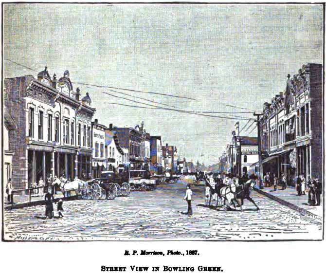
R. P. Morrison, Photo, 1867
STREET VIEW IN BOWLING GREEN
[Page 583]
In bringing these advantages to the notice of manufacturers,
and in offering liberal inducements to such to locate in
their community, the citizens acted with wisdom and
foresight. The people raised in large fund for this
purpose, and the bureau for giving information to investors
was overwhelmed with letters of inquiry; Mr. Brewer,
of the Sentinel, personally answered more than five
hundred. While many of the towns of the northwestern
Ohio lying within the natural gas and oil regions had a
wonderfully rapid development in population, manufacturing
and commercial interests as a result of the discoveries in
oil and gas, probably in no other city was this more
striking than in Bowling Green.
NORTH BALTIMORE is
fifteen miles south of Bowling Green, on the B. & O., near
the crossing of the T. C. & St. L. R. R. It is in the
great oil and gas centre of the State, and is a very
prosperous, growing little city. Newspapers:
Beacon, Independent, G. W. Wilkinson, editor and
publisher; Wood County News, A. B. Smith,
editor and publisher. Churches: 1 Presbyterian, 1
United Brethren, 1 Methodist Episcopal.. Bank:
Peoples', M. B. Walds, cashier.
Manufactures and Employees. - The Dewey Stave
Co., 27 hands; Enterprise Window Glass Co., 67; James
Hardy & Co., general machine work, 6; Rockwell
Brothers, flour, etc., 4; North Baltimore Bottle Glass
Co., 94; A. Barnd, sash, doors, etc., 11. - State
Report, 1888
GRAND RAPIDS
is twelve miles west of Bowling Green, on the Maumee river,
the Miami & Erie Canal, and on the T. St. L. & K. C. R. R.,
which crosses the river by a fine iron bridge 900 feet long.
Newspaper: Triumph, Crosby & Freiss,
editors and publishers. Bank: George P.
Hinsdale. Churches: 1 Presbyterian, 1
Methodist Episcopal, 1 Catholic. It was laid out in
1837, under the name of Gilead, at the head of the first or
Grand Rapids of the Maumee.
Population, 1880, 332. School census, 1888, 163.
FREEPORT P. O.,
Prairie Depot, is ten miles southeast of Bowling Green, on
the O. C. R. R.
Population, 1880, 216. School census, 1888, 204.
TONTOGANY is six
miles northwest of Bowling Green, on the D. & M. and B. G. &
T. R. R. It has 1 Presbyterian, 1 Methodist Episcopal,
and one Evangelical church. School census, 1888, 114.
BRADNER is twelve
miles southeast of Bowling Green, on the C. H. V. & T. R. R.
School census, 1888, 144.
PEMBERVILLE is nine
miles east of Bowling Green, on the Portage river, and on
the C. H. V. & T. & O. C. R. R. Newspaper:
Wood County Index, neutral, C. R. F. Berry, editor.
Population, 1880, 644. School census in 1888,
341; John S. Hoyman, superintendent of schools.
Capital invested in manufacturing establishments, $25,000.
Value of annual product, $26,000. - Ohio Labor
Statistics, 1888.
WESTON is
eight miles southwest of Bowling Green, on the C. H. & D. R.
R. Newspaper: Wood County Herald, Republican,
S. E. Burson, editor and publisher. Churches:
1 Methodist Episcopal, 1 Presbyterian, 1 Catholic, 1 German
Reformed. Bank: Exchange ( A. J. Munn & Co.),
J. V. Beverstock, cashier.
Population, 1890, 845. School census, 1888, 275.
A correspondent writes: "The rural district
surrounding our village is specially adapted to agriculture,
gardening being one of the chief pursuits. Soil very
fertile, and our county contains one of the largest oil and
gas wells in the State. Is bound to become the
wealthiest in every respect of any county also in the
State."
HASKINS is on the
right bank of the Maumee river, eight miles northwest of
Bowling Green.
Population, 1880, 381. School census, 1888, 121.
I. N. Van Tassel superintendent of schools.
[Page 584]
BAIRDSTOWN is sixteen miles southeast of Bowling Green,
on the B. & O. R. R. Newspapers: Times,
independent, G. G. Grimes editor and publisher.
Population, about 350.
MILLBURY is
eighteen miles northeast of Bowling Green, and eight miles
southeast of Toledo, on the L. S. & M. S. R. R.
Population, 1880, 483. School census, 1888, 106.
Census, 1890, 609.
JERRY CITY is ten
miles southeast of Bowling Green.
Population, 1880, 234. School census, 1888, 121.
RISING SUN is
fourteen miles southeast of Bowling Green, on the C. H. V. &
T. R. R.
Population, 1880, 344. |
| |
|
|
|